
Greenland
Real-time state of the 2022-2023
Greenland ice sheet surface mass balance
as simulated by the regional climate model MAR
Surface Mass Balance (SMB) =
snowfall + rainfall - meltwater runoff - sublimation/evaporation
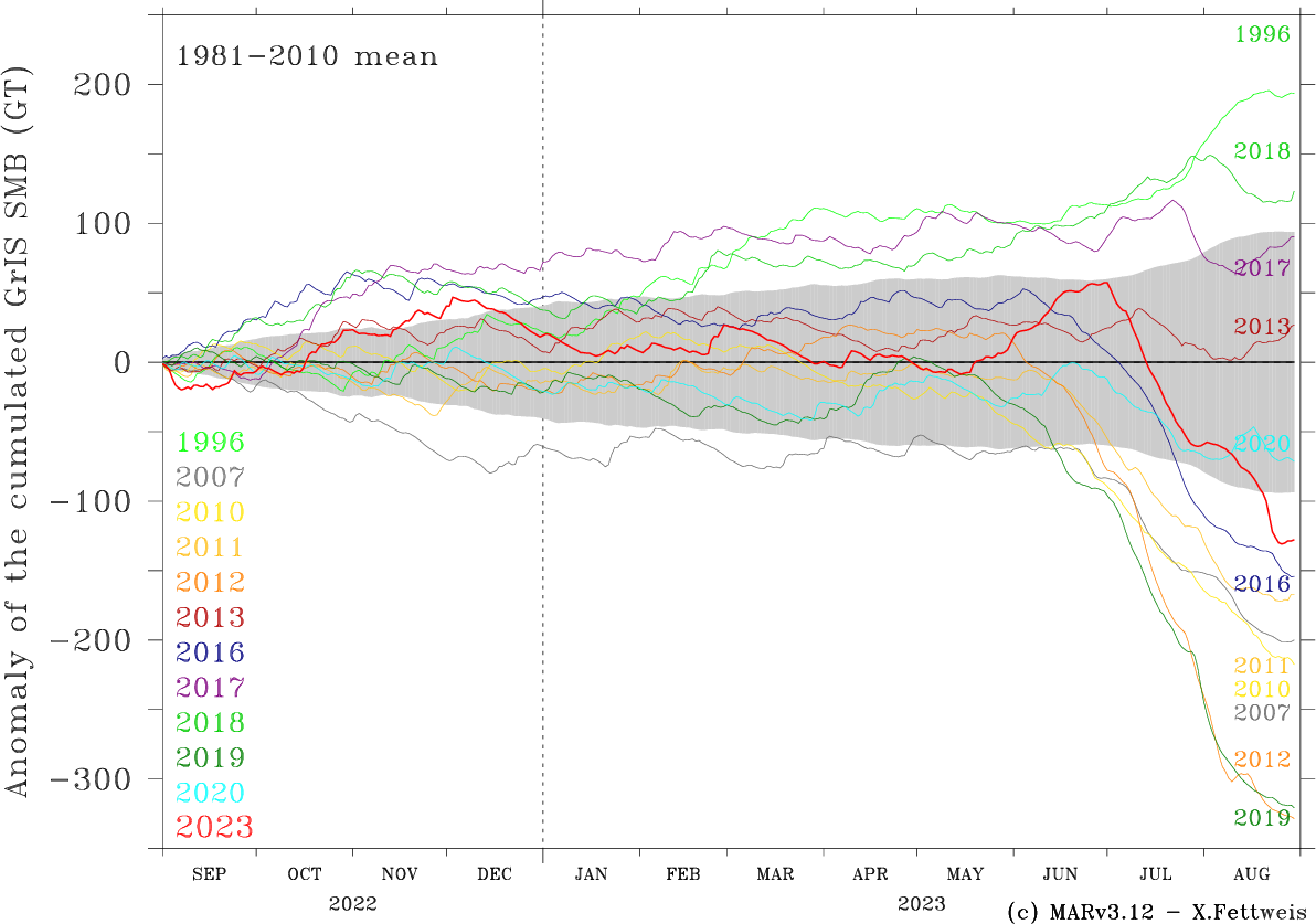
Fig 0: Time series of the anomaly of cumulated Greenland ice sheet (GrIS) Surface Mass Balance (SMB) in GT simulated by the regional climate model MAR (version 3.12, run at a resolution of 20km) forced by the ERA5 reanalysis (till today's date - 7 days) and by the Global Forecast System (GFS) model (today's date - 7 days to the today's date +7 days in forecast mode). The gray shading area represents the 1981-2010 standard deviation around the 1981-2010 average. This plot can be put in parallel with the current state of the Arctic sea ice extent. Negative anomaly means a sea level rise contribution. Finally, the equivalent of this figure but for the other Arctic ice caps is available here.
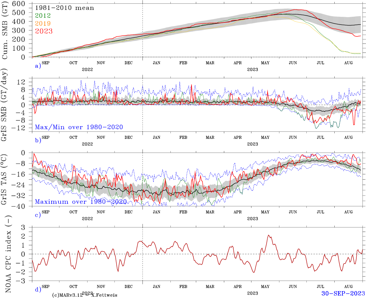
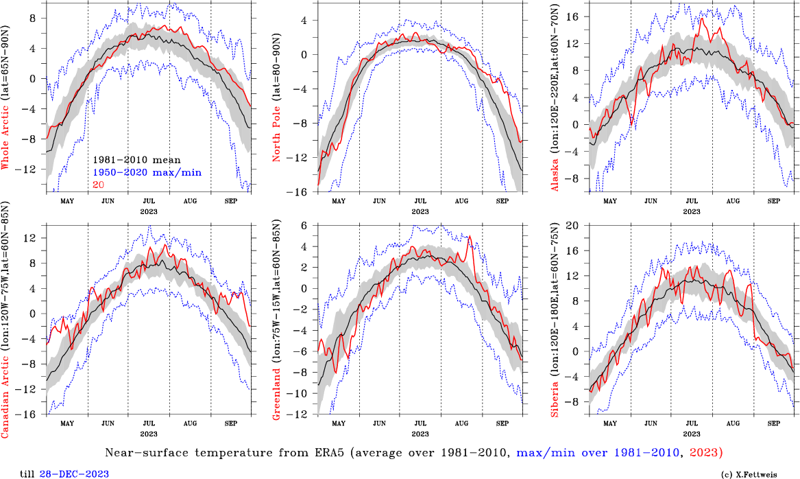
Fig 1: a) Time series of the cumulated Greenland ice sheet (GrIS) Surface Mass Balance (SMB) in GT simulated by the regional climate model MAR (version 3.12 run at a resolution of 20km) forced by the ERA5 reanalysis and by the Global Forecast System (GFS) model (today's date - 5 days to the today's date +7 days in forecast mode) since 1 Sep 2011 (in green), and 1 Sep 2019 (in red). The 1981-2010 mean simulated by MARv3.12 forced by ERA5 is also plotted in black. The 0-24h forecast of each day from the GFS run of 00hTU has been used to build the time series from the end of ERA5 to now. Finally, the gray shading area represents the standard deviation around the 1981-2010 average (in black). b) Same as a) but for the daily SMB in GT/day. The absolute maximum/minimum SMB rate of each day is plotted in blue. c) Daily mean GrIS near-surface temperature (TAS) simulated by MAR. The absolute maximum temperature of each day is plotted in blue. d) Time series of the North Atlantic Oscillation (NAO) index from NOAA e) Time series of the Greenland ice sheet Blocking Index (GBI) from NOAA.
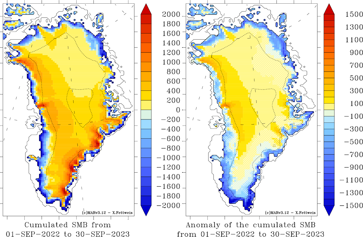
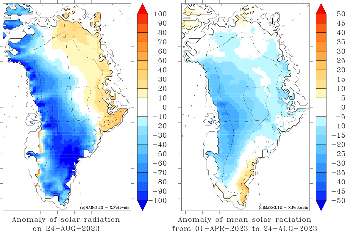
Fig 2a: Left) Cumulated SMB (in mm) from the 1 Sep 2022 to the today's date as simulated by MARv3.12 forced by ERA5/GFS. Right) Same as Left) but in respect to the 1981-2010 ERA5 forced average from the 1 Sep to the today's date. The anomalies lower than the 1981-2010 interannual variability are hatched.
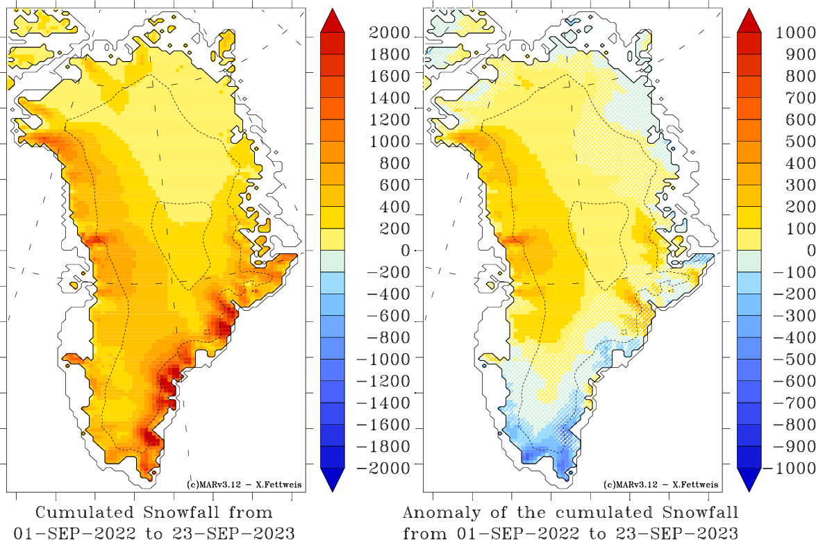
Fig 2b: Same as Fig 2a but for snowfall.
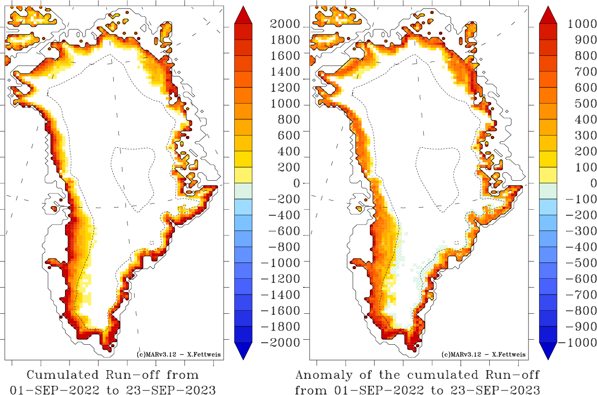
Fig 2c: Same as Fig 2a but for run-off.
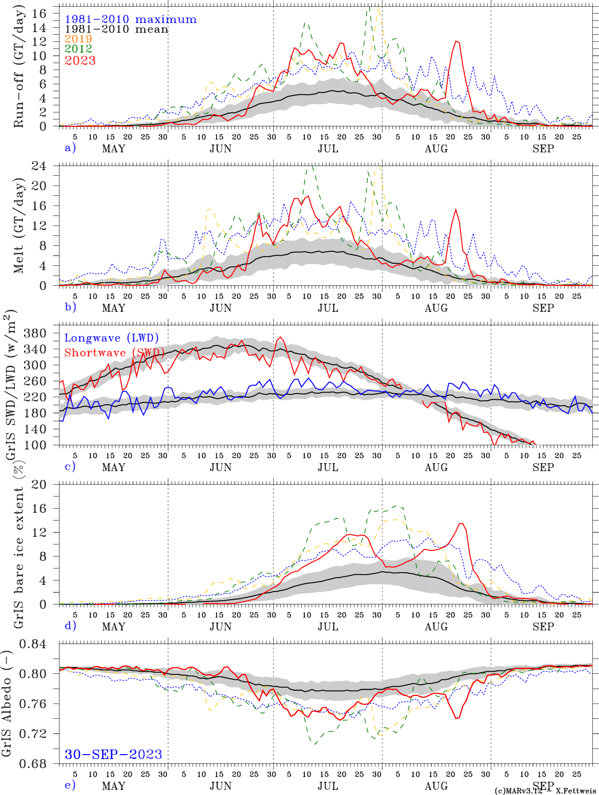
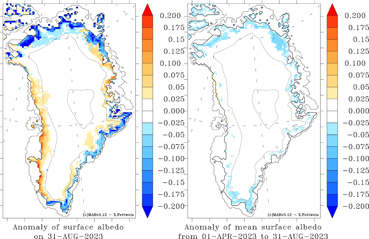
Fig 3: Time series of a) the daily mean GrIS Run-off (in GT/day), b) production of meltwater (in GT/day), c) daily mean GrIS incomming long/shortwave radiation (in W/m²)), d) bare ice extent (i.e. area where the surface density is > 900 kg/m^3 in % of the ice sheet surface) and e) daily mean GrIS surface albedo simulated by MARv3.12 forced by ERA5/GFS (1981-2023).
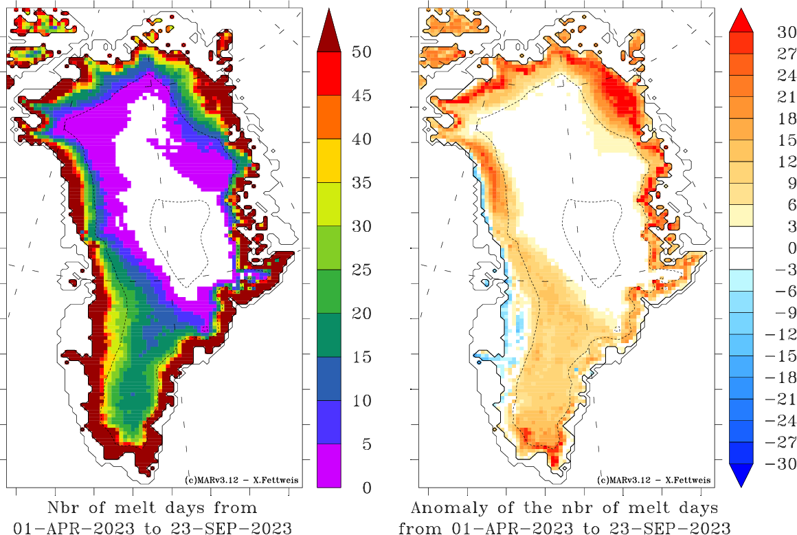
Fig 4: Left) Number of melt days ( (i.e. when the daily meltwater production > 5 mmWE/day) from the 1 May 2023 to the today's date. Right) Same as Left) but in respect to the 1981-2010 average from 1 May to 31 Aug.
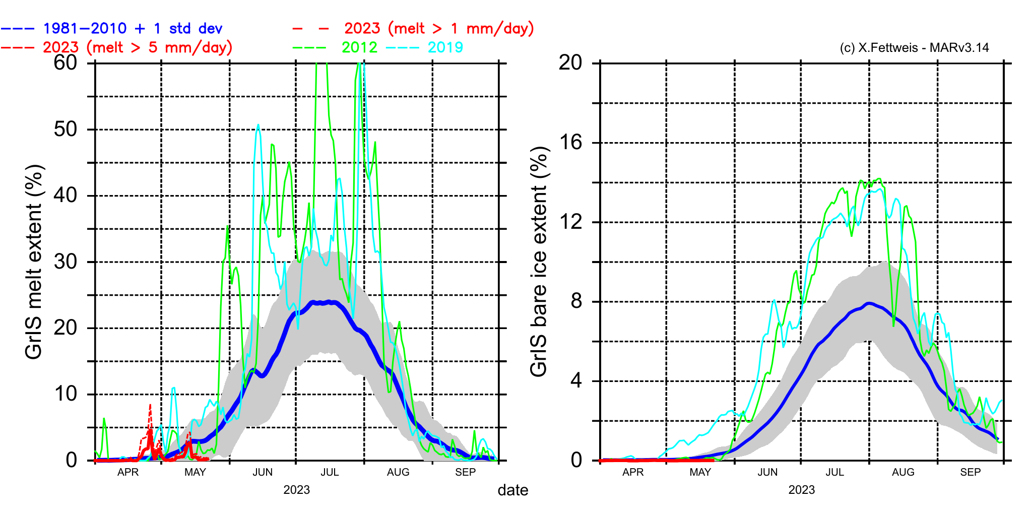
Fig 5a: Left) Melt extent as simulated by MARv3.12 forced by ERA5 and forecasted forced by GFS. Daily meltwater production > 5 mmWE/day (resp. > 1mm/day in dash) is used here as melt threshold in MARv3.12. This melt threshold has been chosen independently of the NSIDC data (see Fig 5b) and the ice mask used here includes both the small perifical ice caps and the main ice sheet, explaining why both estimations do not generally compare. Right) Same as left but for the bare ice extent i.e. the area where the surface density > 900kg/m3.
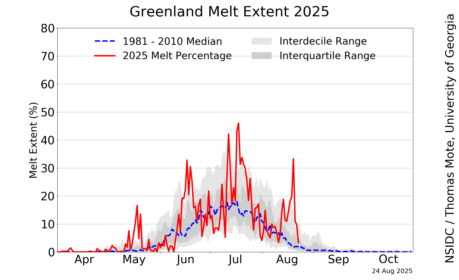
Fig 5b: Melt extent as derived from satellite data (Credit: NSIDC/Thomas Mote). The melt extent shown on this figure can not be directly compared with the melt extent from MAR (Fig 5a) using a different ice sheet mask and a melt threshold.
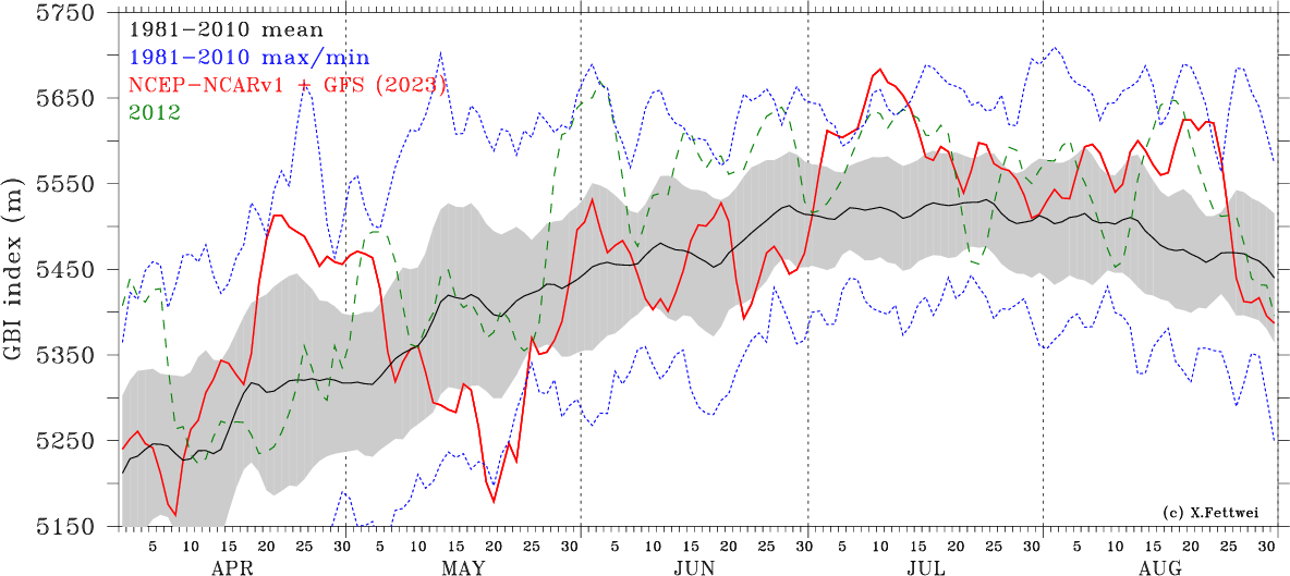
Fig 6: Greenland bloking index (GBI) from NCEP-NCARv1 in red and from the Global Forecast System (GFS) based forcasting in dashed red. According to Hanna et al. (2013), the GBI is defined as the 500hPa geopotential height (Z500) area averaged over 60-80°N, 280-340°E.

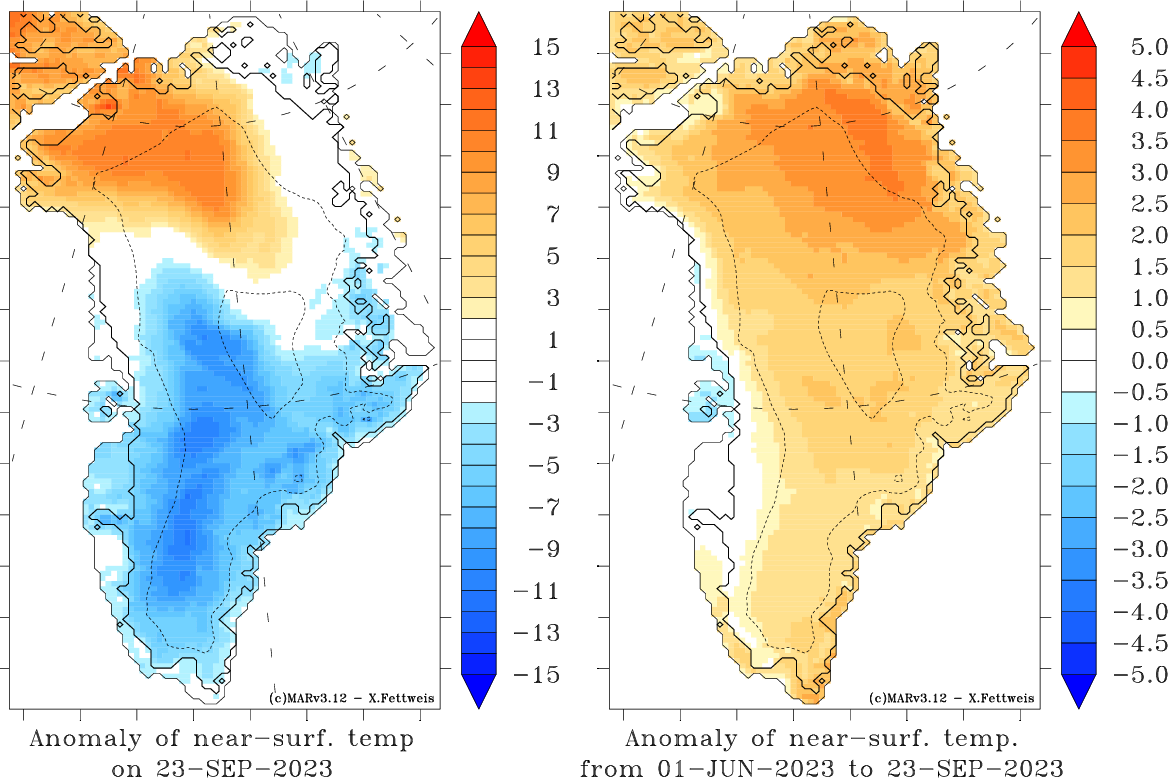
Fig 7: Idem as Fig. 6 but for 700hPa temperature (T700) averaged over 60-80°N, 280-340°E.
Interesting links:
These forecasts are only provided for information in the aim of following the 2022-2023 melting season over Greenland in real time; ULiège can not be held responsible for any use beyond this scope.

Source of this figure: Nowicki, S. M. J., Payne, A., Larour, E., Seroussi, H., Goelzer, H., Lipscomb, W., Gregory, J., Abe-Ouchi, A., and Shepherd, A.: Ice Sheet Model Intercomparison Project (ISMIP6) contribution to CMIP6, Geosci. Model Dev., 9, 4521–4545, https://doi.org/10.5194/gmd-9-4521-2016, 2016.


